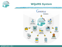
1. This project has received funding from the European Union’s Horizon 2020 Research and Innovation Action programme under Grant Agreement No 101004157 WQeMS | slide 1 | www.wqems.eu WQeMS Services
4. This project has received funding from the European Union’s Horizon 2020 Research and Innovation Action programme under Grant Agreement No 101004157 WQeMS | slide 4 | www.wqems.eu Water Quality Features’ Changes Indicative use - cases 2 . Alerting Scope : allows users to be notified if water quality features in an open surface water reservoir exceed specified thresholds. Actors : Decision maker, Technical officer Pre - Conditions : The user sets in the system the feature for which to be notified by email and sets also relevant thresholds; A water quality feature exceeds specified threshold in the area of interest for the user. Workflow : i . The user receives an email with an indication about the water quality feature exceeding the threshold in the open surface water reservoir of interest. ii. The user accesses the system and visualizes the feature on the map, to further investigate the issue.
15. This project has received funding from the European Union’s Horizon 2020 Research and Innovation Action programme under Grant Agreement No 101004157 WQeMS | slide 15 | www.wqems.eu Water Quality related issues reporting and detection Indicative use - cases 1. Water quality related issues reporting and detection Scope: It allows citizens or water utilities operators to notify the occurrence of water related issues through a dedicated mobile application. Actors: Citizens; Water Utility Operators Pre - Conditions : The user has the app installed in his/her smartphone/tablet; The user is logged in the app; A water related issue occurs. Workflow : i . The user creates a report by including information about the issue (e.g., text, photos, geolocation, etc.). ii. The user sends the report to the system iii. The system stores the report and sends a notification to the decision maker. iv. The system triggers the respective WQeMS service in order to monitor the issue. .
7. This project has received funding from the European Union’s Horizon 2020 Research and Innovation Action programme under Grant Agreement No 101004157 WQeMS | slide 7 | www.wqems.eu Bloom Events Detection Indicative use - cases 2 . Alerting Scope : It allows users to be notified if an algae bloom event occurs in an open surface water reservoir. Actors : Decision maker, Technical officer Pre - Conditions : The user sets in the system to be notified by email and sets also relevant thresholds; An algae bloom event occurs in the area of interest of the user. Workflow : i . The user receives an email with an indication about a bloom event occurrence in the open surface water reservoir of interest. ii. The user accesses the system and visualizes the indicator on the map in order to assess the situation.
13. This project has received funding from the European Union’s Horizon 2020 Research and Innovation Action programme under Grant Agreement No 101004157 WQeMS | slide 13 | www.wqems.eu Extreme Events Detection Indicative use - cases 2 . Alerting Scope : It allows users to be notified if an extreme event occurs in an open surface water reservoir. Actors : Decision maker, Technical officer Pre - Conditions : The user sets in the system to be notified by email and sets also relevant thresholds; An extreme event occurs in the area of interest of the user. Workflow : i . The user receives an email with an indication about an extreme event occurrence in the open surface water reservoir of interest. ii. The user accesses the system and visualizes the maps with the extent of the event (flood/debris or oil spills).
16. This project has received funding from the European Union’s Horizon 2020 Research and Innovation Action programme under Grant Agreement No 101004157 WQeMS | slide 16 | www.wqems.eu Water Quality related issues reporting and detection Indicative use - cases 2 . Alerting Scope : It allows users to visualize alerts generated by: Citizens or water utility operators through the dedicated mobile application; social networks; CitObs API reports. Actors : Decision maker, Technical officer Pre - Conditions : The user is logged in the system. A water quality related issue is registered. Workflow : i . The user receives an email with an indication about an event occurrence in the open surface water reservoir of interest. ii. The user accesses the system interface and visualizes the information about the issue. iii. The user visualizes the results of the triggered WQeMS service (if present) on a map.
12. This project has received funding from the European Union’s Horizon 2020 Research and Innovation Action programme under Grant Agreement No 101004157 WQeMS | slide 12 | www.wqems.eu Extreme Events Detection Indicative use - cases 1. Monitoring of extreme events detection Scope: It allows users to identify extreme events in an open surface water reservoir by visualizing them on a web interface. Actors: Decision maker, Technical officer Pre - Conditions : The user is logged in to WQeMS platform; The system has been pre - configured to monitor the specific area of interest. Workflow : i . The user selects the area of interest. ii. The user executes the Extreme event service (flood/debris or oil spills), by specifying also the date/period of interest . iii. Results are visualised as maps generated by the system.
9. This project has received funding from the European Union’s Horizon 2020 Research and Innovation Action programme under Grant Agreement No 101004157 WQeMS | slide 9 | www.wqems.eu Land - Water Transition Zone Changes Detection Indicative use - cases 1. Monitoring of l and - water transition zone changes Scope: It allows users to obtain maps indicating the transition from land to water and vice - versa at any pixel within a designated area and for a specific time interval, wherein at least two Sentinel - 2 cloud - free images could be registered. Actors: Decision maker, Technical officer Pre - Conditions: The user is logged in to WQeMS platform; The system has been pre - configured to monitor the specific area of interest.
3. This project has received funding from the European Union’s Horizon 2020 Research and Innovation Action programme under Grant Agreement No 101004157 WQeMS | slide 3 | www.wqems.eu Water Quality Features’ Changes Indicative use - cases 1. Monitoring of water quality features’ changes Scope: allows users to obtain current water quality features of an open surface water reservoir by visualizing them on a web interface . Actors: Decision maker, Technical officer Pre - Conditions : The user is logged in to WQeMS platform; The system has been pre - configured to monitor the specific area of interest. Workflow : i . The user selects the area of interest. ii. The user executes the Water Quality Features Changes detection service, by specifying also the date/period and feature (e.g., turbidity) of interest. iii. The user visualizes the feature estimated by the system both on a map and on charts (e.g., time - series with values of the previous days/months).
6. This project has received funding from the European Union’s Horizon 2020 Research and Innovation Action programme under Grant Agreement No 101004157 WQeMS | slide 6 | www.wqems.eu Bloom Events Detection Indicative use - cases 1. Monitoring of bloom events detection Scope: It allows users to identify algae blooms events in an open surface water reservoir by visualizing them on a web interface. Actors: Decision maker, Technical officer Pre - Conditions : The user is logged in to WQeMS platform; The system has been pre - configured to monitor the specific area of interest. Workflow : i . The user selects the area of interest. ii. The user executes the Bloom events detection service, by specifying also the date/period and parameter (e.g., eoHAB , SYKE bloom indicator) of interest . iii. The user visualizes the indicator generated by the system both on a map and charts (e.g., time - series with values of the previous days/months).
10. This project has received funding from the European Union’s Horizon 2020 Research and Innovation Action programme under Grant Agreement No 101004157 WQeMS | slide 10 | www.wqems.eu Land - Water Transition Zone Changes Detection Indicative use - cases 1. Monitoring of l and - water transition zone changes Workflow: i . The user selects the area of interest, two dates, Sentinel - 2 or Sentinel - 1 products ii . The user executes the Land - water transition zone changes detection service, by specifying also the date/period of interest . iii. Results are visualised in a complete and efficient manner. The user has the option to download the output, which is generated both as maps and charts (e.g., time - series of total water extent per date for the period of interest). Specifically, the system generates a map in Geotiff format identifying the change from land to water and vice versa - 4 classes: 0 = Pixel classified as non - inundated in both dates, 1 = Pixel classified as inundated in both dates, 2 = Pixel changed from water to land ( yellow), 3 = Pixel changed from land to water (light - blue) Relevant metadata: Extent of the area that changed; Uncertainty of calculations ( percentage of bad or cloud covered pixels ); Percentage of Corine Land Cover classes that are affected from the calculations.
11. This project has received funding from the European Union’s Horizon 2020 Research and Innovation Action programme under Grant Agreement No 101004157 WQeMS | slide 11 | www.wqems.eu Extreme Events Detection This service allows users to detect and monitor extreme events (i . e . , oil spills and floods/debris) occurring in inland waters such as open surface water reservoirs or rivers . Images of areas affected by the event can be provided to the users through the dedicated web interface of the WQeMS Platform . Moreover, the service can provide to the users customised reports with trends and statistical representations of the occurrence of the extreme events . It is also possible for the users to be notified through different communication channels (e . g . , email, APIs, etc . ) in case an extreme event occurs, which will facilitate emergency management procedures .
5. This project has received funding from the European Union’s Horizon 2020 Research and Innovation Action programme under Grant Agreement No 101004157 WQeMS | slide 5 | www.wqems.eu Bloom Events Detection This service allows users to identify and monitor algae blooms, particularly harmful algae blooms formed by cyanobacteria with potential of producing toxic compounds, in a specific open surface water reservoir . A specific indicator will be provided to the users through the dedicated web interface of the WQeMS Platform . The service will provide to the users customised reports with trends and statistical representations of algae bloom occurrence for a specific time range (e . g . , seasonal, annual, etc . ) . The users can also be notified through different communication channels (e . g . , email, APIs, etc . ) if an algae bloom event occurs, which will facilitate emergency management procedures .
8. This project has received funding from the European Union’s Horizon 2020 Research and Innovation Action programme under Grant Agreement No 101004157 WQeMS | slide 8 | www.wqems.eu Land - Water Transition Zone Changes Detection This service allows users to obtain maps indicating the transition from land to water and vice - versa at any pixel within a designated area and for a specific time interval, wherein at least two Sentinel - 2 cloud - free images could be registered . Inundation maps at two different dates or hydroperiod maps for capturing the seasonal behaviour are utilised . In case of successful implementation of the workflows under research, information about existence and/or changes of the submerged aquatic vegetation may be provided . Users will have access to these maps through the dedicated web interface of the WQeMS Platform . Customized reports with trends and statistical representations may be provided upon user’s request .
2. This project has received funding from the European Union’s Horizon 2020 Research and Innovation Action programme under Grant Agreement No 101004157 WQeMS | slide 2 | www.wqems.eu Water Quality Features’ Changes This service allows users to obtain water quality features of a specific open surface water reservoir (e . g . , turbidity, chlorophyll - a, etc . ) for a specific time range . The produced features will be provided to the users through a dedicated Web interface of the WQeMS Platform . The service will also provide to the users customized reports with trends and statistical representations of the water quality features for a specific time range (e . g . , seasonal, annual, etc . ) . In addition, users can choose to be notified through different communication channels (e . g . , email, APIs, etc . ), in case any water quality features exceed pre - specified thresholds ; this will facilitate emergency management procedures .
14. This project has received funding from the European Union’s Horizon 2020 Research and Innovation Action programme under Grant Agreement No 101004157 WQeMS | slide 14 | www.wqems.eu Water Quality related issues reporting and detection This service allows citizens/water utility operators to report events (e . g . , debris, oil spills, algal blooms) that may affect the water quality in the open surface water reservoirs, through a dedicated mobile application by enabling them to send photos, text and videos about the situation . This information is stored in a repository accessible by the decision maker, who is notified by the system about the occurrence of the event . It also allows decision makers and technical users to be notified about water related issues generated by reports submitted by water utility operators through the dedicated mobile application or through social networks or through CitObs API reports . The registration of an alert can trigger the execution of a related WQeMS service, so that the user can visualize on WQeMS the generated maps and further assess the situation .